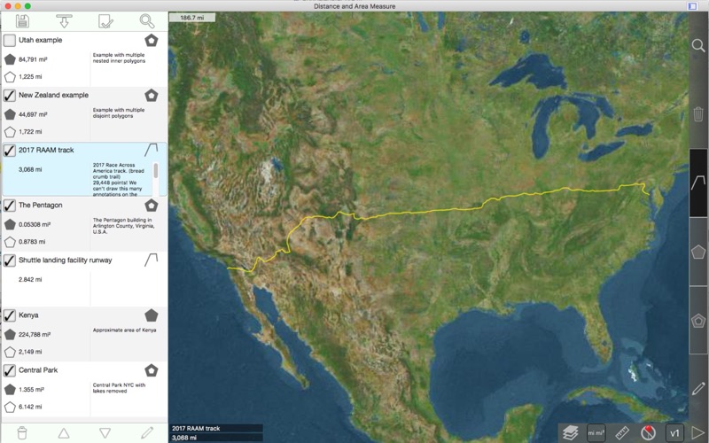
Measure roads, parks, land, countries, lakes, etc from a satellite view. Calculates distances, areas, and perimeters.
Features that this application offers that most competitors do not:
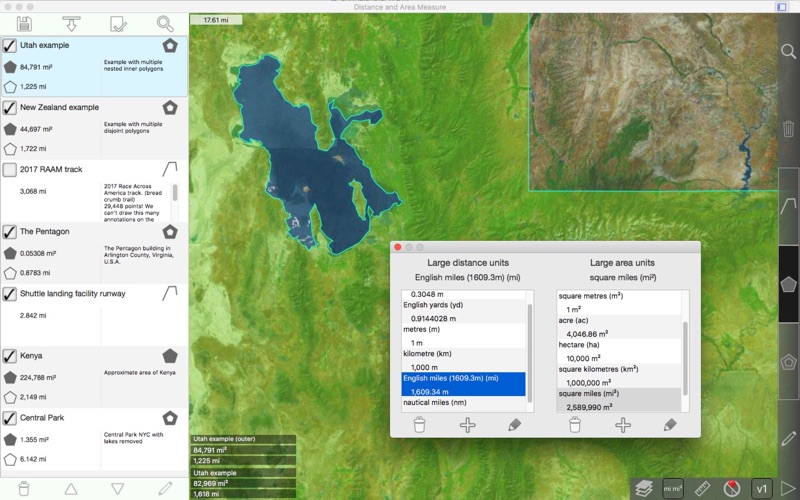
- Custom distance and area units.
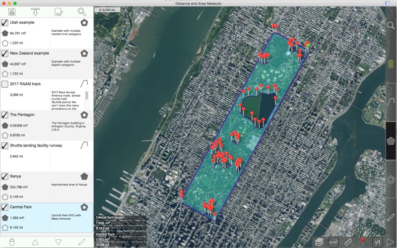
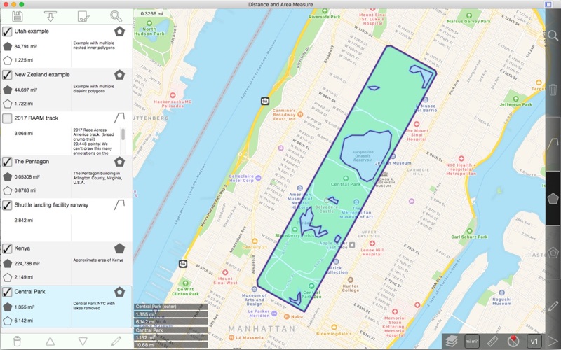
- Draw interior polygons. For example, land area with bodies of water removed.
- Add a point to the middle of a path (Most only allow you to add to the end of the path) Left click to add to the end of a path. Right click to add to the middle of a path.
- Swap two points in a path or polygon.
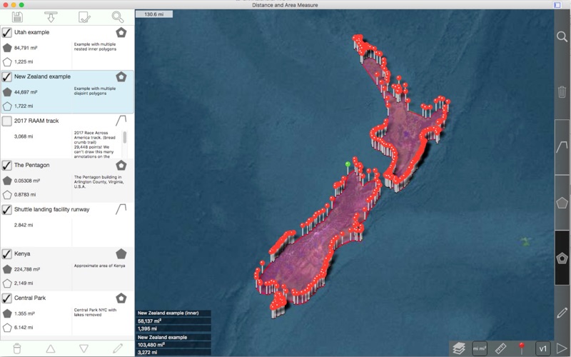
- Can handle complex (self-intersecting) polygons.
- Can handle nested inner polygons.
- UTM and MGRS grids
Features:
- Export and import .kml files
- Pins are draggable
- Name, notes, and color fields for each path and polygon
- 4 verbosity modes.
- Undo / Redo
- Geocoding: Search by postal code, city, address, etc to find latitude,longitude for an address
- Reverse Geocoding: Find nearby addresses for a latitude,longitude
3 drawing modes:
- Path
- Polygon
- Inner Polygon
Values displayed for paths:
- Total distance
- Incremental distance for each waypoint
Values displayed for polygons:
- Area
- Perimeter
- Distance for each side
Add points to a path or polygon in 1 of 3 ways:
- Click on the map
- Enter coordinates manually
- Import .kml file
Default distance units include:
- Kilometers
- Miles
- Nautical miles
- Meters
- Feet
- Yards
Default area units include:
- Meters ²
- Feet ²
- Yards ²
- Kilometers ²
- Miles ²
- Nautical miles ²
- Acres
- Hectares
Coordinate formats:
- Degrees
- Degrees, minutes
- Degrees, minutes, seconds
- UTM (Universal Transverse Mercator)
- MGRS (Military Grid Reference System)
Note that this application uses Apple Maps. We cannot change the satellite images. If you notice that the imagery is out of focus or out of date, please report this to Apple after verifying that the issue also exists in the Maps app from Apple.
Please visit the support page for more information.
 AppGhost.com